
Bushfire
Assessments
Bushfire risk management solutions
At Trend Environmental, we offer comprehensive bushfire risk management solutions tailored to ensure compliance with local and state planning policies. Our services include Bushfire Hazard Assessments, Bushfire Management Plans, and Bushfire Attack Level assessments, all designed to safeguard properties and communities from the threat of bushfires. Trust our expertise to protect your developments with effective fire risk mitigation strategies.

Hazard assessments
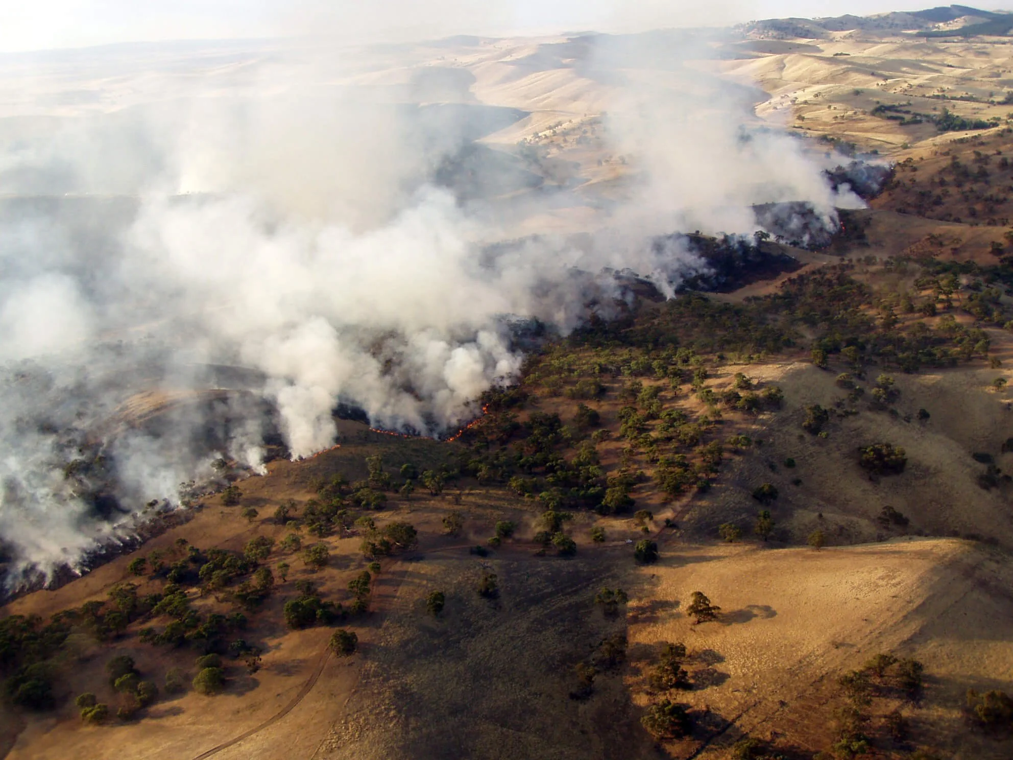
Bushfire overlays are provided as part of Local Council Planning Schemes and these indicate areas of medium or high risk of being subject to a natural hazard including bushfire.
Bushfire hazard mapping is also identified under the State Government Planning Policy, which triggers assessment against the State Planning Policy Assessment benchmarks should the mapping be identified on a property.
If the mapping is identified on a development property, a Bushfire Hazard Assessment is required. These assessments provide site-specific hazard modelling for the property to determine the likely intensity of a bushfire should it occur on the property. Hazard categories include low, medium and high and the property may contain one or all of these categories depending on a number of factors.
These assessments ensure developments (such as subdivisions) are well designed to reduce property and people from the exposure to bushfire.

Bushfire management plans
A Bushfire Management Plan may also need to be developed for the project which will outline the approach to protect built assets and development, and potentially to protect ecological communities.
Management Plans set out the long term strategy for managing fire hazards and risks on the property and include access requirements, firebreak requirements and firefighting water supply requirements.

Bushfire Attack Level (BAL; AS3959)
Bushfire Attack Level assessments are required to construct or extend a dwelling within a Bushfire Prone Area to meet the Australian Standard.
These assessments measure a building’s potential exposure to bushfires and is used to determine construction requirements of a dwelling to improve its protection against future bushfires. Vegetation type, distance from vegetation, and the slope of the land is taken into consideration for these assessments.